
Landsat and Optical Imaging
The curiosity sparked by the Apollo missions’ legacy led to the launching of Landsat, a satellite mission designed to observe and document Earth’s geographical conditions using optical imaging technology.
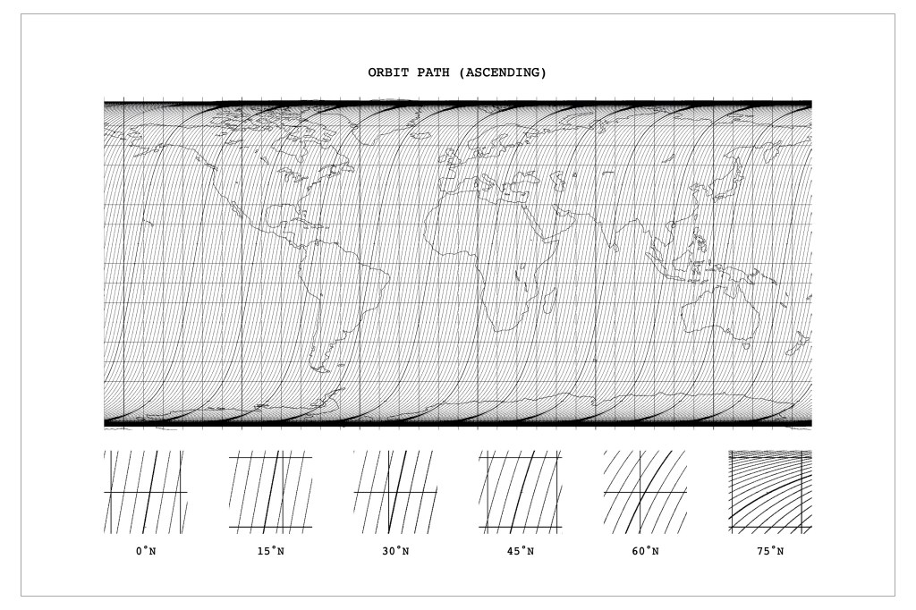
Landsat orbits in a near-polar, sun-synchronous path, enabling it to cover most of Earth’s surface as the planet rotates. Simultaneously, the satellite’s orbit remains synchronized with the sun, ensuring a consistent relationship between the satellite and the sun. The satellites are equipped with sensors that capture electromagnetic radiation including not only visible wavelengths, but also infrared and thermal bands. These sensors collect data as the satellite orbits; the data is subsequently rendered into images that represent land conditions. Each Landsat scene maintains a consistent size, measuring approximately 170 km (106 miles) north-south and 183 km (114 miles) east-west. However, due to its near-polar orbit, Landsat’s coverage is unequal, leading to more frequent imaging of certain areas and leaving others as blind spots.


Leave a comment