
The Gravity Recovery and Climate Experiment
The Gravity Recovery and Climate Experiment (GRACE) is launched in March 2002 by NASA. The mission consists of two twin satellites, orbiting along the same trajectory at a consistent speed, one after the other. The two satellites continuously monitor and measure their distance between one another.
At anytime, changes in their relative positions would indicate gravity anomaly: when the leading satellite encounters a change in the distribution of Earth’s mass, gravity pulls it away from its projected trajectory while the trailing one remains and detects the deviation.
The GRACE satellites launched in 2002 were replaced in 2018 by GRACE-FO to carry on the same mission. Initiated as an experiment to observe gravity, GRACE-FO has since expanded its scope to utilize the data for climate analysis and tracking water movement across the globe.
The flux in water mass causes gravity to constantly change across the globe, along with the LINE that is the sea level. By observing it, GRACE destabilizes the constant that is Earth gravity.
Panta Rhei (“Everything flows”).
– Heraclitus
[MEAN GRAVITATIONAL FIELD]
For mapping anomaly, a model of “norm” is established, which will serve as the baseline. For gravity, the baseline is the “mean gravitational field”, which is derived from averaging long-term gravitational conditions. The method of averaging is common and usually entails sampling across an expanded range of data, whether it’s a long period of time or a large area.
The baseline marks the numerical “0” where everything is measured from. In a larger context, the mean sea level determines the plane of 0 in height where topographic measurement builds upon. As GRACE zooms in incredibly closely into the baseline and measures with great precision, it reveals the minuscule range of oscillation, which transforms the concept of baseline completely.
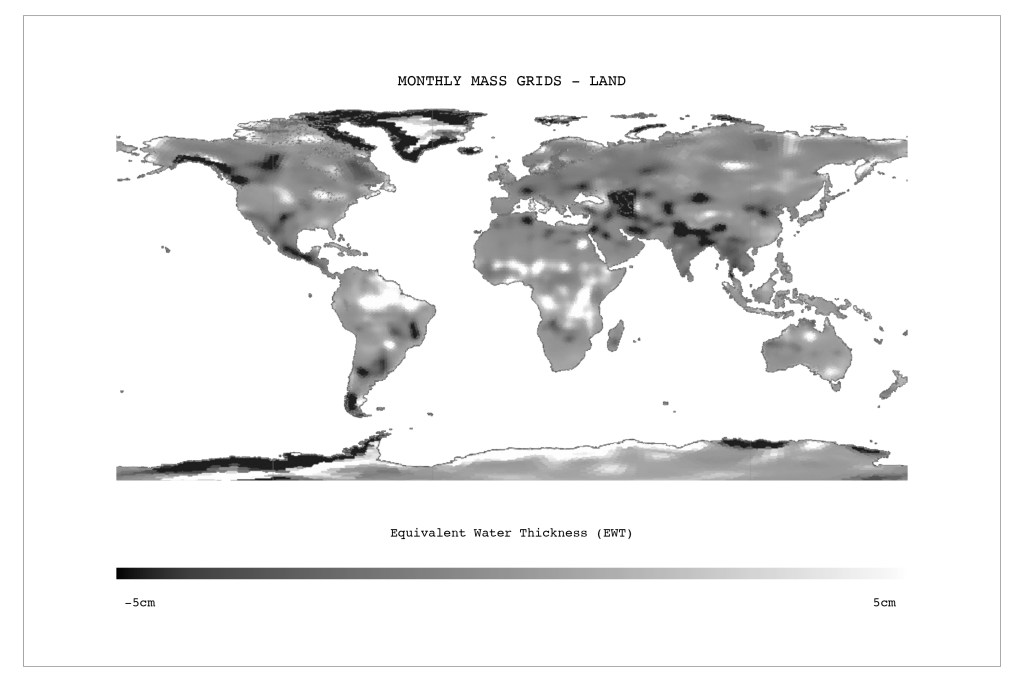
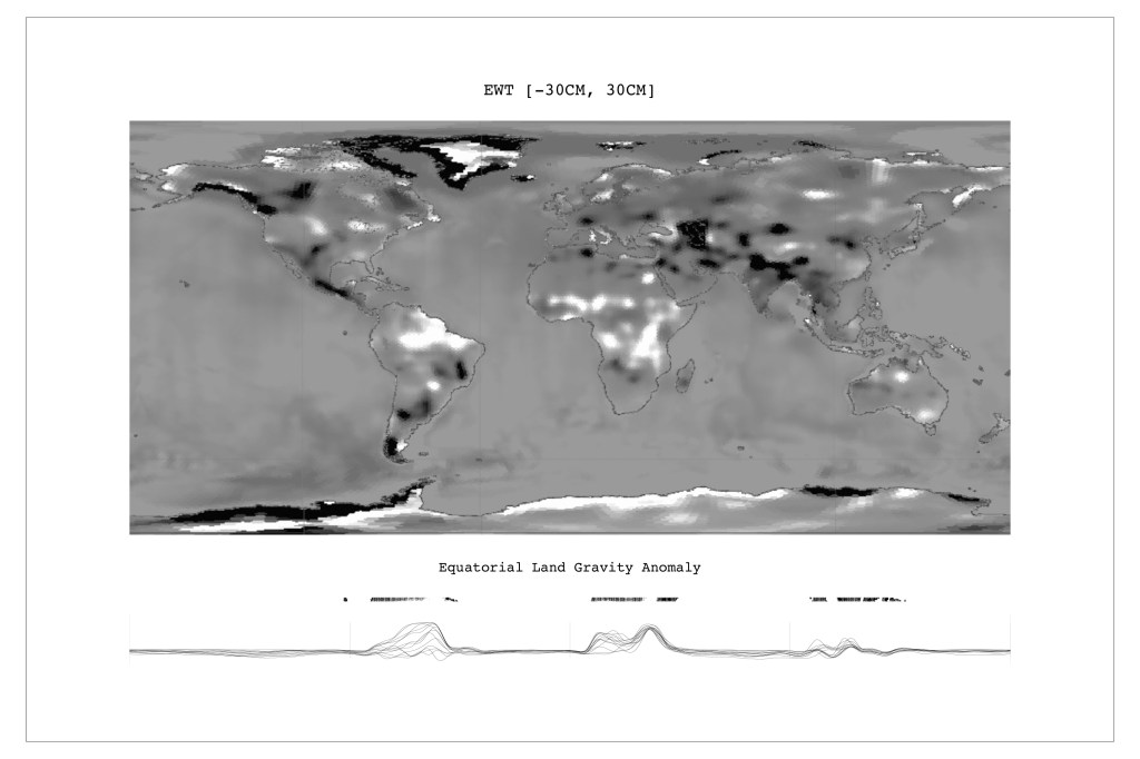
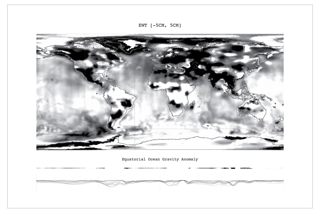
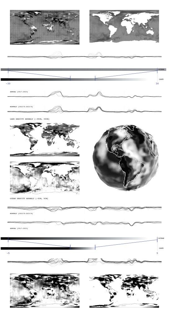
Dehomogenizing gravity furthers the distinctions between ocean and land, as water becomes the indicator for gravity. As Newton’s universal law of gravitation states, gravitational force is proportional to mass; and “mass changes can be thought of as concentrated in a very thin layer of water thickness changes near the Earth’s surface“ (NASA JPL), gravity anomaly is indicated by the property of Equivalent Water Thickness (EWT), in the unit of centimeter.
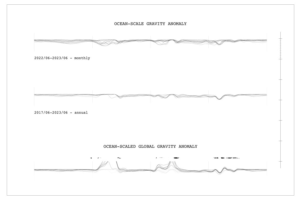
Data collected from GRACE and GRACE-FO are released in two separated sets, OCEAN and LAND, with varying scales. The OCEAN grids map EWT changes ranging from -5cm to 5cm, the LAND grids operate at a greater scale of -30cm to 30cm; since water movements would affect the land more significantly, while the ocean remains relatively stable. This difference is also reflected in data processing for the two separate data sets, concerning range and accuracy.
An ocean model is used to remove high frequency (6-hourly to sub-monthly) wind and pressure-driven ocean motions that might otherwise alias into the monthly gravity solutions. The resulting gravity fields would not reflect ocean variability if the model were perfect.
– “Overview – Monthly Mass Grids.” NASA JPL
Although the Earth’s surface is not uniform, for the most part, the variations are constant over very long time intervals.
– “Gravity/Gravitational Field.” NASA JPL

[SCALING]
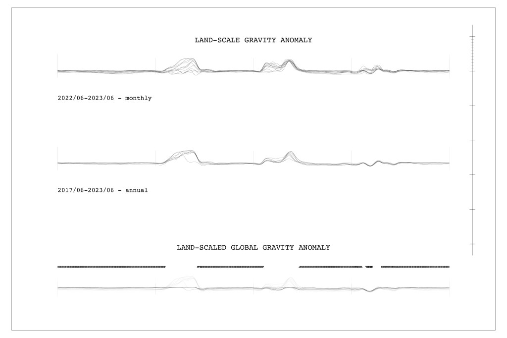
Every instrument of sensing is tuned to a certain range and level of precision, with consideration to its subject. The larger-scale baseline for land is stabilized by the vastness of the ocean; when this baseline is destabilized, the mapping of land flux is affected greatly. Within the same scope, mass flux of land ranges much greater than that of ocean; on the other hand, measuring ocean mass flux calls for greater precision.

Leave a comment